
AI and GIS: Location intelligence at scale
GIS software analyses complex systems and vast datasets to enhance operations. Combined with AI, it delivers insights faster and at unprecedented scale, enabling greater automation, prediction, and optimization.
Automate analytics workflows. Geospatial AI automates data analysis, reducing the time and resources needed to unlock deeper insights from data.
Elevate predictive analytics. Geospatial AI detects patterns and anomalies in vast multivariable data to reduce uncertainty, spot opportunities, and model future scenarios.
Optimize operational performance. Geospatial AI models and monitors operations in real time to iteratively refine solutions that maximize resources and drive efficiencies.

Trusted AI
Ensuring security and managing risks
Trusted Artificial Intelligence (AI) at Eagle Technology is a strategic, enterprise-wide commitment embedded across our technology, services, and operations.
How Eagle Is Leading the Way with AI Innovation
Bringing GIS capabilities to AI
How we move beyond simple chatbots over our geodatabases to create tools and agents that actually make users more productive, provide location analytics to the non specialist and provide the analysts tools help them do their job more efficiently and effectively.
AI Strategy for GIS
The Convergence of GIS and AI
As artificial intelligence rapidly reshapes industries, geospatial professionals face an important question: how can organisations harness AI effectively while avoiding the risks, and missteps that often accompany emerging technologies?
Understanding AI Capabilities and how they relate to GIS
How your organisation benefit from AI
Despite the overwhelming complexity of AI concepts, terminology and technical approaches, most AI technologies can be understood through four foundational pillars.
Geospatial AI is already transforming industries
Versatile across sectors, the technology brings clarity to complex operations by revealing opportunities and risks.
Monitoring changes automatically and at scale
Microsoft partnered with Esri and Impact Observatory to build an AI-powered land-cover map. Geospatial AI enables automated land-use monitoring at 10-meter resolution, significantly increasing the scale and frequency of global observations compared to previous methods. The capability will help answer pressing questions about the human footprint, weather pattern changes, and environmental issues.

Getting ahead of business risk
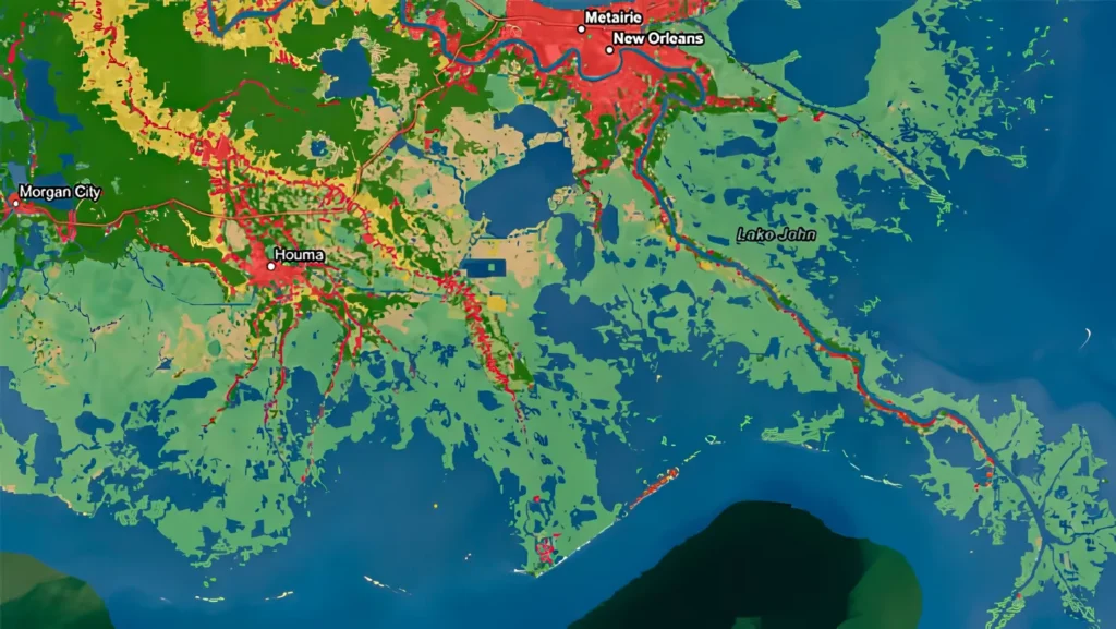
AT&T used climate data and geospatial analysis to map potential flooding risks to its US infrastructure through 2050. Geospatial AI made it possible for the company to identify which facilities and supply chains may be vulnerable to coastal flooding. The detailed analysis produced powerful information that other organizations can use to evaluate their own risks.
Predicting maintenance on critical highways
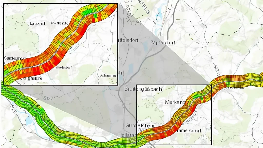
The Bavarian State Ministry of Housing, Building, and Transport piloted an artificial intelligence system to assess road conditions on a major German highway. Predictive analysis with geospatial AI analyses images to identify early signs of road wear, showing exactly when and where to schedule maintenance before major repairs are needed. The project proved these approaches can realistically forecast changing road conditions.

Optimizing forest growth and production
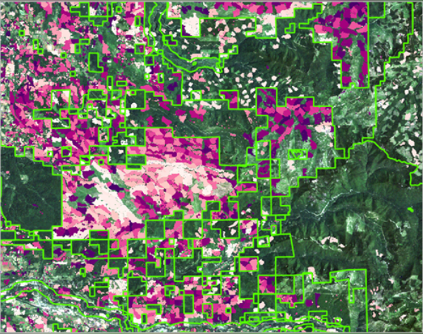
Automation has improved the management of Finnish forests and helped fill an employment gap. Artificial intelligence analyzes imagery and weather data to better predict forest inventory and maintenance needs. Geospatial AI supports proactive management and refinement of growth patterns and harvest cycles.
Saving $100 million per year
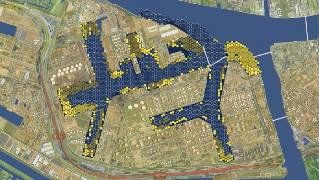
The US Army Corps of Engineers dredges ports and shipping channels to maintain the water depths needed for cargo vessels to safely navigate US waterways. With geospatial AI, planners analyse millions of vessel-tracking pings to show locations where barges and container ships are getting slowed by sediment. Predicting where to dredge helps the Corps be proactive and precise, fine-tuning operations to save $100 million a year.
ArcGIS is the leading software for geospatial AI
ArcGIS is the world’s leading GIS software, with mature, proven, embedded AI. Made by Esri, ArcGIS is an enterprise geospatial platform that delivers the advantage of a geographic approach to problem-solving. It integrates smoothly with other business systems and enables AI-powered geospatial analysis across all data.
Equipped with pretrained AI models
ArcGIS includes more than 75 pretrained models that have been battle-tested for common workflows such as object detection in imagery.
Access to comprehensive data
Unparalleled authoritative datasets and high-resolution imagery significantly enhance AI capabilities, ensuring accuracy and speeding analysis.
Simplified user experience
AI assistants and conversational interfaces boost productivity, ease adoption, and democratize spatial analysis across organisations.