RUCs 2026 - Coming to a centre near you
March 16 2026 - This year's 8-centre Regional User Conference series kicks off in Wellington on the 23 March.
Eagle Technology is once again collaborating with the NZ Esri Users Group to bring you the 2026 Regional User Conference roadshow.
These are the largest GIS conference series in New Zealand, bringing together the Esri user community for a day of presentations, coffee, networking, and technical updates.
Registration is now open for all of the venues!
Eagle Technology Appoints New CEO, Graeme Henderson
Auckland, NZ (15 December 2025) — Eagle Technology, a leading New Zealand-owned and operated IT company, has appointed Graeme Henderson as Chief Executive Officer.
The appointment signifies a shift as the company continues to grow.
Duane Eagle, Managing Director, who has led the business since 2017, says the establishment of the role is a fitting and natural progression, as the business transitions into 2026 and the opportunities that will bring.
“Graeme has a deep understanding of our business and a proven record of driving growth, fostering innovation, and building high-performing teams. Most recently, he served as Sales Director, leading strategic transformation, expanding markets, and delivering strong revenue growth.
Graeme has more than 10 years of leadership experience at Eagle Technology. He sees significant potential for furthering the company's reach.
“I am honoured to step into this role at such a pivotal moment as technology is evolving,” said Henderson.
“Eagle has built a foundation from which we will continue to support our customers, innovate, and advance our mission to bring excellence to all that we do.
“I look forward to working closely with the Board and the entire team.”
Eagle Flyer
For the latest news, you can read our July 2024 newsletter here
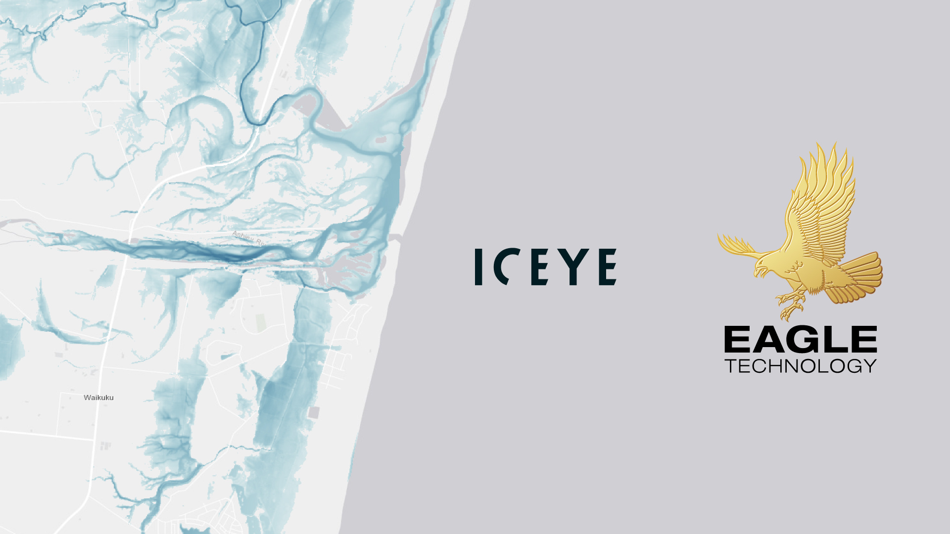
ICEYE enhances flood intelligence availability for New Zealand with Eagle Technology agreement
Helsinki, Finland – 15th July, 2024 – ICEYE, a world-leading provider of natural catastrophe solutions and insights, has announced an analytics data reselling partnership with Eagle Technology, an information management company, to sell and deliver the ICEYE Flood Insights product for New Zealand as a reseller partner.
Eagle Technology is the distributor for Esri’s ArcGIS platform in New Zealand and the South Pacific, the global leader in GIS technology, mapping, and spatial analytics software. ICEYE’s flood intelligence services will be available for customers to purchase for the ArcGIS platform, benefiting commercial entities, including insurance companies, as well as emergency management agencies.
A warming climate resulting in increased humidity is expected to increase the frequency and severity of flood events across the regions.
“ICEYE is a global Esri partner with its ArcGIS system-ready solution, delivered as a feature in Image Layers, for which it won an award at Esri’s 2023 Partner Conference. With the recent weather events and the expected ongoing effects of climate change, we are very pleased to bring this technology to New Zealand and our customers,” says Duane Eagle, Managing Director, Eagle Technology.
In the event of a major flood anywhere in New Zealand, subscribers to the ICEYE near real-time analysis will be able to access observation derived flood analysis, including overall extent measurements and flood inundations levels at the property level. These insights will support faster loss assessments, improved claims management, and more accurate capital allocation as well as bolstering disaster response efforts.
Commenting on the announcement, Paul Barron, Global Head of Partnerships at ICEYE, said: “Providing increasingly rapid access to near real-time hazard analytics data in the Esri platform through Eagle Technology will make it easier for clients to access and benefit actionable intelligence during events to improve decision making and facilitate speedier responses. I am excited to have Eagle Technology as an ICEYE partner.”
About ICEYE
ICEYE delivers unparalleled persistent monitoring capabilities to detect and respond to changes in any location on Earth, faster and more accurately than ever before.
Owning the world's largest synthetic aperture radar (SAR) satellite constellation, ICEYE provides objective, near real-time insights, ensuring that customers have unmatched access to actionable data, day or night, even in challenging environmental conditions. As a trusted partner to governments and commercial industries, ICEYE delivers intelligence in sectors such as insurance, natural catastrophe response and recovery, security, maritime monitoring, and finance, enabling decision-making that contributes to community resilience and sustainable development.
ICEYE operates internationally with offices in Finland, Poland, Spain, the UK, and the US. We have more than 700 employees, inspired by the shared vision of improving life on Earth by becoming the global source of truth in Earth Observation.
Media contact: press@iceye.fi
Visit www.iceye.com and follow ICEYE on LinkedIn and X for the latest updates and insights.
About Eagle Technology Group
Eagle Technology Group Ltd is a privately held New Zealand-owned information management company, formed in 1969. It has approximately 140 employees with offices in Auckland, Wellington and Christchurch.
Eagle Technology has a long-established and successful geospatial technology practice in Geographic Information Systems (GIS) and related technologies as well as expertise and experience in on premise ICT infrastructure and managed services provision.
Eagle Technology is the distributor for global software leader Esri’s ArcGIS platform in New Zealand and the South Pacific. Its traditional client base is in government, local government and enterprise class commercial organisations.
Media Contact:
Sarah MacDonald, Marketing Manager
svm@eagle.co.nz

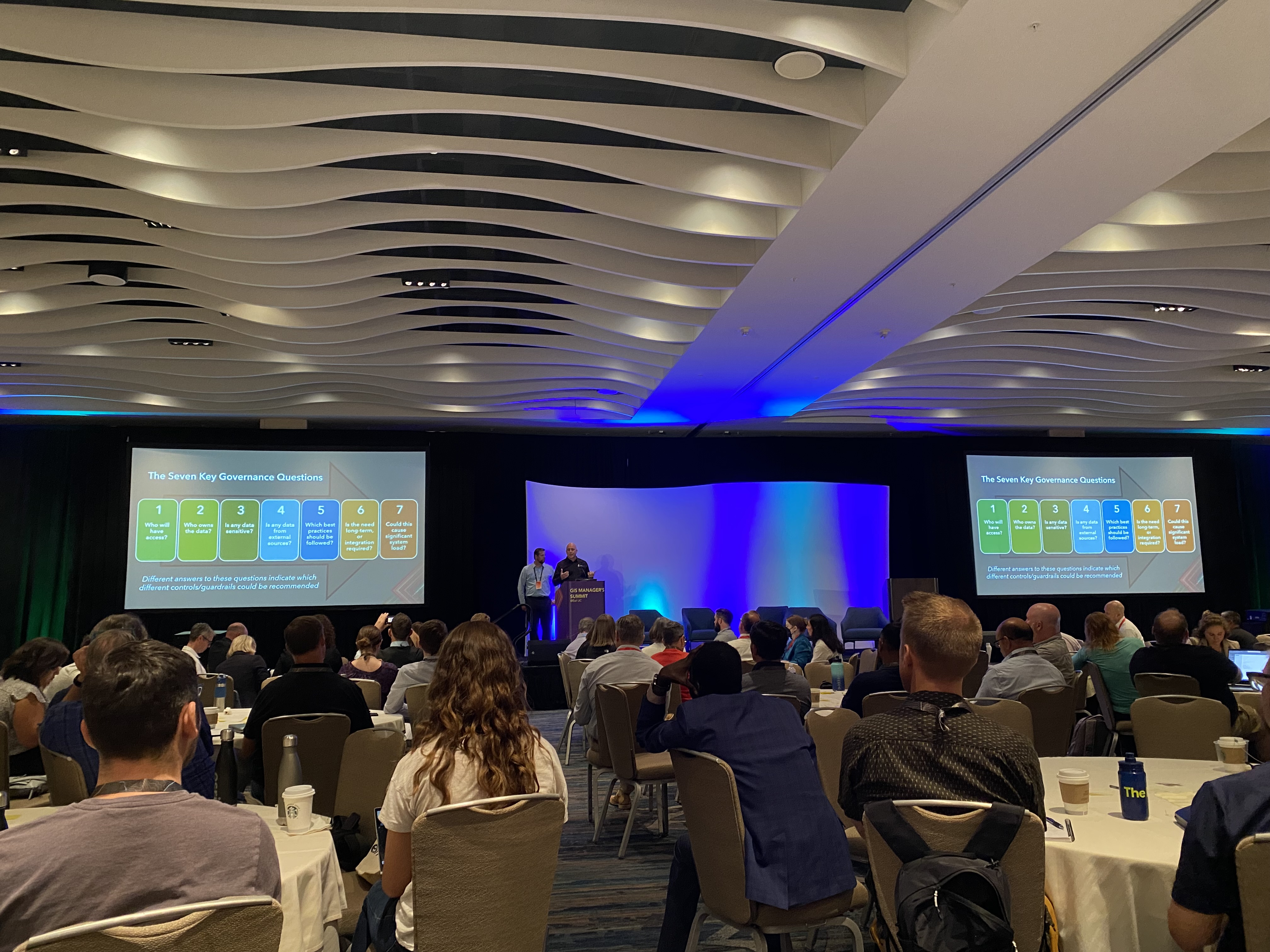
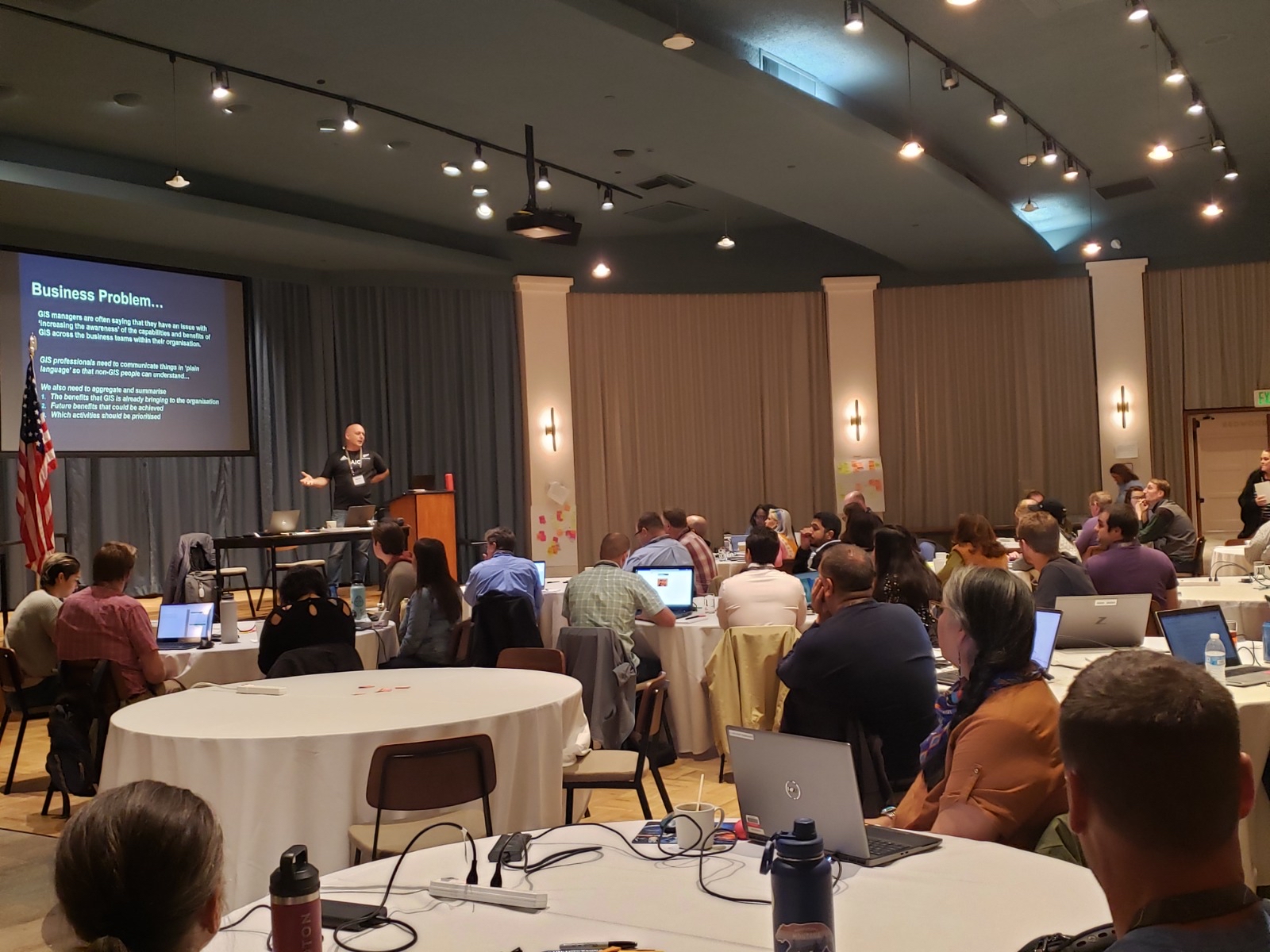
Putting NZ on the Map at the GIS Manager's Summit in San Diego
As a part of the annual Esri User Conference in San Diego, a summit event is held especially for GIS managers and leaders. This event has rapidly grown in popularity with around 500 international attendees in 2024. This year Eagle Technology's Nathan Heazlewood was invited by Esri to present in recognition that Eagle Technology's knowledge of topics such as geospatial governance and strategy stands amongst the best in the world.
Christie Pleiss (Esri Director, Professional Services) said, "The topics and best practices shared support and enable leadership development and success of geospatial programs. Really appreciate Eagle Technology's support of this event and having Nathan as a presenter and key expert!"

Eagle Technology's staff have also been heavily engaged with Esri's internal strategic consulting and executive consulting groups. Nathan attended the URISA GIS Leadership Academy in California in 2022, as well as being asked by Esri to be one of the leaders of the Esri Strategic Consulting Community of Practice.
James Pardue, who is an Esri Strategic Consultant and organiser of the event said: "Our presenters and panellists did an outstanding job sharing their own journeys, experiences, best practices, and lessons learned. This event has now become a professional development event for current and future GIS managers and leaders and a wonderful opportunity to network and grow. Eagle Technology's participation was a vital piece to the summit's success by sharing their own tips, tricks, and tools that help support success in strategy and governance development."
Also working in this area and recognised as being world-leading, is Esri Canada. Nathan worked closely with Matt Lewin and Allen Williams from Esri Canada to create a joint presentation on 'Tips and Tricks for GIS Success'. The event this year attracted around 500 GIS managers and leaders from around the world, including representatives from several New Zealand organisations. Nathan was also part of the Esri team that organised the event. That team is thrilled with the record-breaking attendance and increasing interest. Feedback following the event indicates that many attendees rated it as the best day of their time at UC.
Adam Carnow, who has been a key organiser of this event for more than a decade, said that "the 2024 GIS Manager's Summit was the largest and best yet in its twelve year history, and much of the credit goes to the contributions from two very important Esri distributors, Esri Canada and Eagle Technology. The work they are doing is contributing significantly to the expanding best practices around the business of GIS. The GIS leadership community must recognise the importance of the work being done by talented professionals like Nathan Heazlewood. His presentations on tips, tricks, and tools for success on governance and understanding business needs, were on point, providing applicable frameworks based on decades of experience, and ready for implementation. The value of this work to the GIS community is significant and Esri looks forward to continuing to collaborate with Eagle Technology on this critical work."
Nathan thoroughly enjoyed working with our international colleagues, stating, "Matt and Allen have produced some fantastic articles, resources and webinars on these topics so to be presenting on stage alongside them at an important event such as this one is a pinnacle of my career".
If you are planning on attending the International Esri User Conference in the future, make sure to check out this summit (which is typically on the Sunday prior to the main plenary).
Going to California… to discuss GIS Strategy and Climate Change Analysis - Nathan Heazlewood
- July, 2023
At the end of 2022, I had the privilege to attend two excellent events in the USA. One focussed on GIS leadership, and the second discussed the connections between climate, weather, and the oceans. These were some of the most rewarding GIS events that I have ever attended, so I am very thankful to Eagle Technology for giving me this amazing opportunity. It is my belief that the topics raised are critical for where the GIS industry is right now and there were dozens of key learnings that I have brought home with me to share with the industry in New Zealand. What follows are some key observations that I made during these events. 
Event 1: URISA GIS Leadership Academy: Santa Rosa
The URISA GIS Leadership Academy is a professional development program designed for GIS leaders or professionals who aspire to take on leadership roles in their organisations. The academy aims to provide participants with the skills and knowledge they need to succeed in management and leadership positions. The academy is offered by URISA (Urban and Regional Information Systems Association), a non-profit professional organisation that promotes the effective use of spatial information and GIS technology. The GIS Leadership Academy took place over a week in the beautiful vineyard region of Northern California.
During the academy we learned about leadership and management principles, communication strategies, organisational change management, and strategic planning. There were structured lessons, resources, and activities but a key benefit of the week was the opportunity to network with other GIS managers and to gain insights from experienced leaders in the field.
Examples of some of the key learning points:
- From a strategy perspective, it is important to monitor what is going on in the world around you as well as look introspectively at what is currently happening at your organisation- sooner or later external factors will impact you too.
- We struggle with justifying the benefits of GIS to executives- sometimes there is a 'golden minute' at the end of a project when the customer/users are really pleased (however often they give that feedback verbally or in a meeting): grab that moment (or maybe right after the meeting) and ask the customer to just put that feedback into a simple couple of sentences in an email- this can be gold for proving the benefits of a future project.
- "Leadership is solving problems. The day staff stop bringing you their problems is the day you have stopped leading them. They have either lost confidence that you can help or concluded you do not care. Either case is a failure of leadership."
- Celebrate the successes of your team using many approaches. In some cases this might be getting them to present their work to their colleagues or at a conference, in other cases, this might be doing a site visit to see the benefits of their work 'in the real world'.
Personal Observations
There were a few things that struck me personally about this event:
It was an honour to be the sole Kiwi at this event, but even though the vast majority of the attendees were from North America they face the same challenges that we do at home. People often think of the USA as being all like New York or Los Angeles, but in reality, most of the USA and Canada are made up of medium to small-sized cities, which have a lot more in common with Hutt City or Hamilton than you would expect. A lot of the issues that we discussed were exactly the same as we experience in New Zealand/Aoteroa.
The academy sessions were maybe 50% instructor-led and 50% contributions from the audience. I was pleased to be able to contribute to several of the lessons (even taking to the stage at one point to give an impromptu presentation on GIS benefits and ROI). As mentioned above these challenges are worldwide, and from the feedback I received, they were very thankful for some insights from down-under.
Having the opportunity to network with a smallish group of about 50 GIS leaders all staying for a week at the same venue was awesome - you really got to know people and to have some great conversations, if not in the lessons then over a coffee or over dinner. I was particularly pleased to get to know people that I have only met with online (including the fantastic instructors such as Tim Nolan and John Nolte). I was also very happy to get to meet a large contingent of native Americans representing the Bureau of Indian Affairs - it was great to see how Indigenous communities are expanding their GIS leadership capabilities. I think that there is something about people that chose to specialise in GIS: they are generally wonderful people no matter where in the world they come from: as geographers we tend to take a keen and caring interest in our environment and society.
Event 2: Esri Ocean, Weather, and Climate GIS Forum
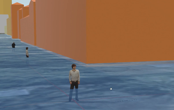
The forum covers a wide range of topics, including data acquisition and management, data analysis and visualization, modeling and simulation, and decision-making support systems. The conference provides an opportunity for attendees to learn about the latest GIS technology and solutions, and to network with peers and experts in the field. The goal of the conference is to foster collaboration and innovation in the application of GIS technology to address the complex challenges facing the ocean, weather, and climate scientific communities. I was also fortunate to be able to undertake a pre-event training course on using ArcGIS pro to analyse and visualise the implications of coastal inundation, including some very realistic 3D visualisations of what is likely to happen to different cities in coming decades, with the ability to zoom in to individual houses or businesses.
Key learning points:
- There will be far-reaching implications of climate change, many of which are not obvious to people. Some examples: the rising water table will affect the sub-surface foundations of buildings and sub-surfaces of roads is something that geo-technical engineers are concerned about. The general public also doesn't tend to be aware of the implications for sewage systems and septic tanks, buried landfills, or other contaminated sites (unfortunately following recent weather events some regions have been getting nasty surprises about this).
- The FAIR Principles need to be applied to this data. The meaning of each one of these items needs to be properly interpreted (for example 'Accessible' to whom?)
- Open Data is not enough: in order for data to be FAIR curation by a trusted authority and explanation about how to use and interpret the data is needed. One of the problems with providing Open Data on its own is that while it might be amazing and accurate scientific data if it is not explained well enough to multiple target audiences then its value will be diminished.
- In the USA they are already planning for when certain critical crops will no longer be viable in coming decades and where production will need to be migrated to.
- Inter-agency collaboration is essential, including public-private-NPO and international. I was pleased to hear work being done with New Zealand agencies, particularly NIWA, being mentioned several times by partner agencies from around the world.
- The UN Sustainable Development Goals identify challenges, action & measure progress. It is useful to have a framework that everyone can understand and use can use in a consistent way. This is something that we need to adopt more in New Zealand.
- Improvements in data processing and data management techniques mean that we are increasingly able to process and align massive datasets, including in real-time. This is important to be able to analyse vast quantities of data quickly.
- It was interesting for me to see the approach that the insurance industry is taking to this (which will bypass the political aspects of any debate). Another interesting observation was how seriously the US military is taking climate change: they assert the implications for naval facilities in particular: will prove to be incredibly costly.
- The impact of climate change will be trillions of dollars of capital and affect countless lives: evidence from trusted, authoritative sources is vital.
Personal Observations
- It was amazing to talk to the actual front-line scientists from the likes of NASA, NOAA, and USGS. The people who are actually putting up the satellites or down the submersibles and are the ones gathering the primary data. I was pleased that in general, while these aspects of geospatial analysis are not my specialty (impostor syndrome in overdrive), nevertheless I was actually able to follow along and understand most of what was being said.
- As my new friend and fellow surfer George McLeod from Old Dominion University explained: as scientists, we need to explain as widely as possible & in as many ways as we can. My favourite quote from the forum was: "What I see as our mandate as people that create geovisualisations is to tell the story of coastal flooding and sea level rise in as many ways as we possibly can. There is no one way to tell the story. The story might hit one person in one way and it might hit another person in another way, so why pick just one channel."
- It was a pleasure to be kindly hosted by my colleagues at Esri, who welcomed me as part of the Esri Distributor network, treating me as part of the team.
- It is great to see the work that Esri is doing with these branches of science. In the words of Jack Dangermond: "It's evident as well that our most difficult challenges—including the climate crisis but also social and economic inequality—are inherently tied to issues of geography. Key to understanding such issues and acting on them is knowing what is happening where, why they happen where they do, and what might happen next in any specific location."
For a more detailed review of the Ocean, Weather and Climate Forum see: https://www.linkedin.com/pulse/ocean-weather-climate-forum-2022-review-nathan-heazlewood
If you would like to discuss any of the items in this article then please get in touch with the Eagle Technology GIS Business Consultancy Team.
RE: Disaster Response Program Activated – Eagle Technology
10/12/2023
In response to Tropical Cyclone Gabrielle, Eagle Technology, through its Disaster Response Program is monitoring and ready to assist in the following four specific areas:
1. Additional licensing – This is no-cost service through the Disaster Response Program that provides temporary licenses for up to three months. Learnings from previous events is to be proactive, and request licenses pre-event TODAY through the below email.
2. Imagery provision – We are a reseller of both MAXAR/ Planet Premium Imagery, and at-cost can task, process, analyse and disseminate imagery on your behalf.
3. Additional resourcing – We can provide remote and/or on-site/remote CIMS4 trained GIS specialists (non-chargeable/chargeable depending on circumstances).
4. Technical advice – If there is anything you’d like a second opinion on, our Disaster Response Team are happy to offer their experience and knowledge to answer any questions you may have.
5. We also have relevant links to datasets and tips for response available here: https://storymaps.arcgis.com/stories/fbdc295be69e422daca3c45fb2b13a33
If you require any of the above, please contact emsupport@eagle.co.nz. Normal GIS support is also available during business hours, please contact gissupport@eagle.co.nz or 0800 7 EAGLE.
Kind regards,
Eagle Technology
Esri COVID-19 GIS Hub
This hub provides a collection of authoritative global datasets, reporting dashboards and other useful content. This includes access to ArcGIS Online with ArcGIS Hub Basic as well as the ArcGIS Hub Coronavirus Response template.
Eagle Technology Farewells Chair and Co-Founder, Corallie Eagle

Corallie and Trevor Eagle
It is with great sadness that we inform you of the passing of Corallie Eagle, Chair and co-founder with her late husband, Trevor Eagle, of Eagle Technology Group Ltd. Corallie passed away peacefully at her home on Saturday, April 10, 2021 after a long illness.
Established in 1969, Eagle Technology has remained a privately held information technology company. Following Trevor's death in 2000, Corallie became Chairman, and remained on the board until her passing. Son Duane Eagle is the Managing Director of Eagle Technology and will continue to lead the company as he has done so for the past five years.
Trevor and Corallie are well known for their support to sport, science, education, community and environmental organisations. Eagle has sponsored the Harbour Swims, AUT Computer Awards, Ellerslie Racing Club, NZ Young Executive of the Year, and the NZ Biosecurity Awards, among others. Trevor also held executive positions including Auckland Area Chairman of the Duke of Edinburgh Awards and was a trustee of the Worldwide Fund for Nature (WWF). Corallie was herself an Auckland Table Tennis representative achieving a New Zealand ranking, and after Trevor passed she continued to champion sponsorships, making time always to attend the various events and awards.
As testament to the longevity of the company in the fast-moving technology sector, Corallie leaves behind a legacy of innovation and forward-thinking. Eagle's 120 employees include interns straight from university study, to veterans of 25 years and more, reflecting the culture of trust and loyalty.
Eagle Technology specialises in mapping software and spatial analytics (GIS) as well as on-premise and cloud ICT infrastructure, and is the distributor for global software Esri's ArcGIS platform in New Zealand.
Corallie is survived by her five children Taryn, Craig, Chanel, Fleur and Duane, and eight grandchildren. Committed to the Catholic faith, Corallie now joins her beloved husband Trevor, and her much-loved children Brae and Heath.
Duane Eagle, Eagle Technology and the Eagle family thank you all for your ongoing support.
Eagle Flyer - February 2021
View our latest newsletter here
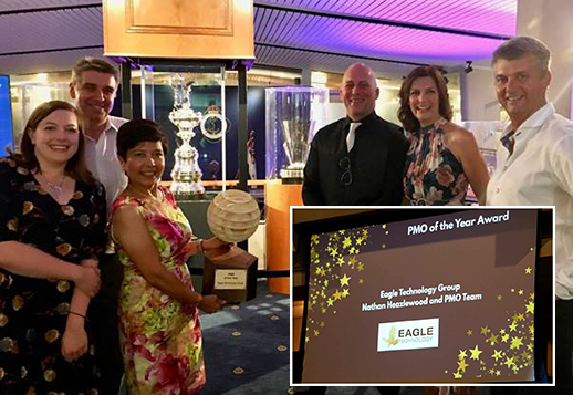
Eagle Technology has been awarded the prestigious 'Project Management Office of the Year' by the New Zealand Project Management Institute, as part of the PMINZ Awards 2020.
This is particularly pleasing as the awards extend beyond GIS to incorporate all IT and construction projects.
The award was presented by one of the judges, Peter Nicholas (Capital Portfolio Manager at Fonterra).
In announcing the winner Peter said, "The award submission told a detailed and compelling story about setting objectives to create an effective Project Management Office through the development of great practices and capability amongst the people and the organisation.
Things that stood out included delivering projects with strong stakeholder engagement, that was really clear, some really great acknowledgment of results from the customers, and we also appreciated the examples of building their team through professional associations. Also, some great work supporting academic community engagement and learning. The judges were really impressed by the quality of the submission".
Accepting the award, Eagle Technology PMO Team Lead, Nathan Heazlewood, gave credit to all of the team that is involved with projects, as well as the clients that they work with. He made special mention of the contribution that GIS has made to the response of many agencies to the Covid Pandemic and dedicated the award to the professionals that we work within emergency response, defence, health and other critical agencies.
Eagle Technology's Managing Director, Duane Eagle, regards the award as acknowledging the exceptional work performed by the PMO Team. He says, "We are very proud to have the Eagle PMO Team named as Project Management Office of the Year, well done to the team".
PRESS RELEASE 27 OCTOBER 2020
Eagle Technology signs Partnership Agreement with Planet
Auckland, NZ (27 October 2020) — Eagle Technology has entered into a new partnership with Planet, the leading provider of global, near-daily satellite imagery data and insights.
Eagle Technology is the distributor for Esri’s ArcGIS platform in New Zealand and the South Pacific, the global leader in GIS technology, mapping, and spatial analytics software. The partnership gives customers the ability to purchase Planet’s high-cadence imagery directly from Eagle.
Planet’s mission is to image the entire Earth every day and make change visible, accessible, and actionable. By providing insights into daily changes occurring in communities, the way is clear for smarter land-use planning and strategic decision-making.
Customers can access and integrate Planet’s imagery within their workflows for deep-level analyses using ArcGIS Pro geoprocessing tools to build models, perform raster operations, or apply machine learning to Planet’s analysis-ready imagery data.
“Esri’s imagery analysis and change detection is a logical fit with Planet’s mission to make global change visible,” says Duane Eagle, Managing Director, Eagle Technology.
“Planet’s imagery, combined with ArcGIS software, means our customers can plan and monitor workflows with current imagery to map and track change more frequently than ever before.”
“We are very excited about our partnership with Eagle Technology. Our mutual alignment with Esri and the calibre of skills they bring to market will help customers see immense value from access to Planet’s satellite imagery and analytics.” says Simon Campbell, Director Channels & Alliances APAC, Planet.
For more information:
Email:planet@eagle.co.nz
Doug Stark: 021 24 8 4868
PRESS RELEASE 21 OCTOBER 2020
Eagle Technology signs Partnership Agreement with Clearion
Auckland, NZ (20 October 2020) — Eagle Technology has entered into a new partnership with Clearion, a Gold Tier member of the Esri Partner Network.
Founded in 2007, Clearion meets the market with technology that addresses the needs of vegetation management programmes mired in paperwork to manage safety and compliance. Initially centered on Utilities’ works programmes, Clearion’s field planning applications, mobile applications and asset mapping workflows have expanded to include Telecom, Gas and Transportation.
At its core, Clearion utilises the Esri platform, with its suite of web portals, dashboards, and cross-platform mobile applications.
Eagle Technology is the distributor for Esri’s ArcGIS platform in New Zealand and the South Pacific, the global leader in GIS technology, mapping, and spatial analytics software.
“We have already seen the advantages of the Clearion solution as utilised by WEL Networks during the Covid-19 lockdown. WEL was able to digitally schedule and assign work to vegetation teams adhering to strict COVID-19 social distancing and contact tracing requirements,” says Duane Eagle, Managing Director, Eagle Technology.
“Esri users already have the tools for implementing Clearion in a single, integrated system and delivers across multiple user platforms including web, desktop, tablets, and other handheld devices.
“Clearion has enjoyed collaborating with Eagle Technology over the past several years, and we are excited to formalize our work together through this new partnership,” adds Chris Kelly, Clearion Co-founder and CEO.
“The success of WEL Networks and our other early adopters in New Zealand demonstrates the fit of the Clearion solutions in the market. It also highlights the ability of utility and infrastructure organisations in New Zealand to successfully deploy and adopt geospatial software solutions that dramatically improve the safety and effectiveness of maintenance operations. We look forward to seeing this success extend out to other utilities and transportation organisations across the country under our partnership with Eagle Technology.”
For more information:
Web: www.eagle.co.nz/utilities
Email: clearion@eagle.co.nz
Dan Clark: 021 274 9753
About Clearion
Clearion’s technology helps solve complex infrastructure maintenance and construction workflows. From supervision to design, planning to the crew, Clearion delivers across multiple user platforms including web, desktop, tablets, and other handheld devices.
Clearion is a leader in end-to-end technology solutions designed to help companies radically transform their work environments, strengthen communication among workgroups, and serve their customers more effectively.
Clearion works with leading utility, telecom, gas, and transportation companies across the globe to solve complex operational challenges—and provide highly innovative solutions to aid in the design, construction, and maintenance of utility assets and large-scale infrastructure. Clearion is a Gold Tier member of the Esri Partner Network.

Maps for Farm Management
Maps have always played an important role in farm management. Now with technologies like geographic information systems (GIS) the maps are digital and that, says, Eagle Technology' Lauren McArtney, means they can do much more with them.
Unlike paper maps, GIS maps are living documents. Farmers can update them in an instant and share them with key stakeholders such as suppliers, government or customers. They represent the real world as a series of spatial layers. These layers represent the location of key assets, the distribution of soil types, farm activities or crop health. Armed with digital maps farmers can manage the various aspects of the farm in a dynamic and connected way including bringing in live data feeds from sensors or third party data-feeds.
McArtney says GIS is an important way to support health and safety processes on a farm. She says: "Making a farm safe is about understanding hazards, visualising them and sharing that information in an easy to understand map for any visitors or contractors. Incidents or fresh risks can easily be recorded when and where they occur and used to act as well as for reporting. This means recording health and safety isn't a separate task, and it becomes part of a farm's everyday workflow.
Scott Campbell, Eagle Technology's Head of GIS technology says farmers have, for a while, been capturing drone and satellite imagery and internet-of-things (IoT) sensors and these too have a location associated with them and are being incorporated within a farm's GIS.
Campbell says "These data sources, as well as being more dynamic, can give access to valuable layers of data (for example productivity, water quality, soil moisture or weather conditions) which can be connected to other layers providing a more complete picture such as continuous temperature, water quality, crop productivity and understand how these affect one another: this takes advantage of the basic value of GIS which is connecting things through a shared location."
Farmers have used drones for some time. Campbell says a drone can capture video footage that can become a two or three-dimensional image-based farm map.
He says: "Increasingly farmers make maps using information the infrared and ultraviolet areas beyond the visible spectrum. This allows them to pick up information about things such as vegetation health."
ArcGIS provides the farmer with tools and maps that help decision making and in turn, makes for greater productivity, less waste and better sustainability.
More information:
Eagle Technology Agribusiness Lead: Murray McCallum
E: mrm@eagle.co.nz
M: 021 763 044
www.eagle.co.nz/agtech
Register for the Eagle Technology Agtech webinar: https://bit.ly/3fHwXN1
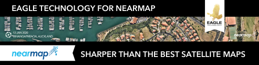
Eagle Technology signs Reseller Agreement with Nearmap
Auckland, NZ (9 June 2020) — Eagle Technology is pleased to announce that it has signed a reseller agreement with Nearmap, one of the ten largest aerial survey companies in the world by annual data collection volume, specialising in high-resolution aerial imagery.
Nearmap collects imagery using patented, airplane-mounted camera systems to cover wide land areas at high-resolution in a short amount of time, and publishes up-to-date orthographic imagery of 73% of the New Zealand population within days of capture.
Easy to use, Nearmap subscription-based model allows access to high-resolution imagery in the cloud, from any device, that can be accessed via Nearmap web application, ArcGIS, or through integrations with other major GIS and CAD platforms.
In New Zealand, Nearmap covers 14 urban areas encompassing more than 18,890 square kilometers annually and growing. New content for major New Zealand cities is added frequently at a minimum resolution of 6cm GSD, providing both currency and quality of imagery. Selected populated regional areas are updated at least once a year. Nearmap imagery consists of both recently captured and historical imagery — allowing for comparisons and aiding survey data.
“Nearmap’s imagery and business model is a welcome and logical addition to our GIS product and partner offerings,” says Duane Eagle, Managing Director, Eagle Technology.
“The availability of data for customers including in Government, Local Government, Utilities, Transport, and the Architecture, Engineering and Construction sectors, where we can provide a one-stop experience and support, is a win for those many organisations that use the ArcGIS platform.”
For more information:
Email: nearmap@eagle.co.nz
Doug Stark: 021 248 4868
About Nearmap
Nearmap brings the real world to you. Nearmap delivers high-resolution aerial imagery as a service to businesses across the world, powered by
industry-leading geospatial mapping technology. Using its own patented camera systems and processing software, Nearmap captures wide-scale urban areas in North America, Australia and New Zealand, making fresh content instantly available in the cloud via web app or API integration.
Every day, Nearmap helps thousands of users conduct virtual site visits for deep, data-driven insights—enabling informed decisions, streamlined operations, and robust bottom lines.
Founded in Australia in 2007, Nearmap is publicly listed in the ASX 200. For more information, visit https://www.nearmap.com/nz/en

UPDATE 30 March 2020 - Accessing your ArcGIS Licenses working from the Home Office
As the situation surrounding COVID-19 continues to evolve, Eagle Technology is committed to keeping its people safe and is following guidelines from the Ministry of Health. We have now activated our business continuity plan so that we can continue to support all our customers. This means that the majority of our staff will be working remotely, leveraging the necessary technology to continue business as usual.
What will this mean for you? You will still be able to contact all staff whilst accessing the services and support you need. Communications will move to a virtual-first approach which includes meetings, events, and training where, for example, all instructor-led courses will now be delivered online until further notice.
For users of Esri software and services, Esri has released the following statement, with Eagle Technology's support:
Esri is fully prepared to maintain operations during the coronavirus disease 2019 (COVID-19) pandemic. We have not experienced any significant business impact or interruption. We have a business continuity plan in place across all business units, including technology support and customer service, to ensure resilience. We will continue to fully serve our users, partners, and employees without disruption.
Additionally, we wanted to highlight the following resources currently available for you to access and use:
Esri COVID-19 GIS Hub – this hub provides a collection of authoritative global datasets, reporting dashboards and other useful content. This includes access to ArcGIS Online with ArcGIS Hub Basic as well as the ArcGIS Hub Coronavirus Response template.
Request for Eagle Assistance – locally, Eagle's Emergency Support Programme is available for requests for assistance related to such emergency events as COVID-19. Our team work with Esri's Disaster Response Programme team to support you in times of need.
Alongside these, our dedicated support lines continue to remain open:
General: https://www.eagle.co.nz/it-services/support
GIS specific: https://www.eagle.co.nz/gis-solutions/gis-support
Eagle Technology will continue to keep you informed of any changes to these arrangements and appreciate your flexibility and support during this unprecedented situation we are facing.
Please stay healthy and take care of one another and your families.
Regards,
Duane Eagle
Managing Director
Eagle Technology
NZTM Basemaps zoom levels upgrade
Beneath every engaging WebMap, lies an unsung hero: a Basemap. A Basemap provides a background of geographic context for the content in your maps. Eagle Technology offers a range of Basemaps in the New Zealand Transverse Mercator (NZTM) Projection that you can choose from when you create a new map. These Basemaps are used by hundreds of organisations across New Z, with the most popular of the bunch being the New Zealand Imagery Basemap, one which is updated regularly with the latest publicly-owned aerial imagery. Over the years, we have seen the usage of our Basemaps grow, and in those years, the requirements of our users have changed. That is why we'll be making some changes to our existing Basemaps.
As part of its definition, every Basemap has rules to say how far you can zoom in and out in most of the apps and over the years we have received requests to allow for more zoom levels to support different use cases. A couple of years ago we added more zoom levels to our imagery Basemap, which now zooms in to 1:282.
Later this month (planned for 4pm Wednesday 18/12/19) we will be expanding the zoom levels even further for all our Basemaps. We will add levels to the smaller scales (to allow you zoom further out beyond New Zealand's coastline) and more importantly add new zoom levels to the larger scales (for zooming right in). The smallest scale will be 1: 591,657,527 and the largest scale will be 1:70.
Please find more information about the transition and how it may affect you see the blog
Vector Basemaps in NZTM
To complement our existing raster Basemaps, the content team is working hard on the next generation of Basemaps in the New Zealand Transverse Mercator projection: vector Basemaps. These Basemaps are cached and delivered as vector tiles and are rendered client-side based on a style file that is delivered with the vector tiles.
The content team has released the second beta of the NZ Topographic Map and will be fully releasing that map soon. You can find the layer and map in this group (be sure to join this group as we will be adding the final releases and new beta styles to this group). The NZ Topographic Map is based on the World Topographic map from Esri. After the NZ Topographic Map, we plan on releasing more styles as vector Basemaps like the Canvas maps, Navigation map and a hybrid style that can be overlaid with the NZ Imagery Basemap.
Please keep an eye out on our blog post where we will be adding more information shortly more information about the new Vector Basemaps and how you can style them and add them to your Basemap gallery.
Submissions are now open for the NZ Esri Young Scholar Award 2020
- Registration for Esri Education Summit @ Esri UC and Esri International User Conference, San Diego
- Travel, accommodation and meal costs (to a maximum of 7 nights)
- Award and photo with Jack Dangermond, President, Esri
- An ArcGIS Personal Use License
The award is presented at a Special Achievement in GIS award ceremony during the week of the Esri UC 2020, July 13 – 17, San Diego, CA.
What you need to know:
- You must be aged 30 or younger
- You must be enrolled in an undergraduate or graduate program in a New Zealand university 2020 OR have graduated from a New Zealand University in 2019
How should you apply?
Submit your entry to gistraining@eagle.co.nz by 5pm, 3 April, 2020.
Your submission should include*:
- A brief summary of your project and how you used ArcGIS in one or more of the following areas of benefit:
- Furthering Scientific Knowledge, in a relevant area of study such as marine biology, geography, geology etc.
- Better decision making, using GIS to allow an organisation or individual to make more informed decisions based upon locational data and analysis, possibly combined with non GIS information.
- Managing geographically, GIS is becoming essential to understand what is going on. Using GIS to improve understand of a process such as development of a landform, environmental impact of chemical discharge, spread of disease.
- An A2 or larger poster illustrating your maps and summarising your use of GIS technology in your project (PDF or PNG format at 300 dpi resolution)
- A self-photo (head and shoulders) at minimum 300 dpi resolution
*A link to a downloadable file on Dropbox or similar is acceptable Terms and Conditions
Eagle Technology enters counter-drone market

New Zealand Biosecurity Awards
Eagle Technology is proud to support the New Zealand Biosecurity Awards. What work are you doing that you may consider entering?
It takes all of us to protect what we've got but there are a few champions worth celebrating.
The New Zealand Biosecurity Awards recognise and celebrate outstanding contributions to protecting our country.
Much of what we do to protect our biodiversity in New Zealand is through biosecurity activity – from trapping rats in backyards to washing and disinfecting footwear when visiting our kauri forests.
The Awards acknowledge people and organisations across New Zealand who are contributing to biosecurity – in our communities, businesses, on-farm, on-orchard, iwi and hapū, government, in the bush and in our backyards.
If you or someone you know is doing great work to protect New Zealand against pests and diseases, it's time to shine a light on their achievements.
Entries for the Awards are now open 18 June until 5pm 24 July 2019. Visit ThisIsUs.nz/biosecurity-awards to find out more and enter.
New Zealand Biosecurity Award categories are:
- Department of Conservation Community Pihinga Award
- Department of Conservation Community Kahiwi Award
- Te Puni Kōkiri Māori Award
- GIA Industry Award
- Eagle Technology Local and Central Government Award
- Bio-Protection Research Centre Science Award
- Mondiale Innovation Award
- AsureQuality Emerging Leader Award (open to nominations)
- Minister's Biosecurity Award (open to nominations)
- Supreme Award (awarded to one of the category winners)
You can enter more than one category and it's easy to enter online. Visit ThisIsUs.nz/biosecurity-awards.
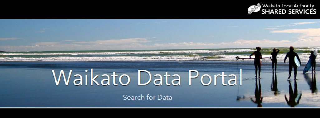
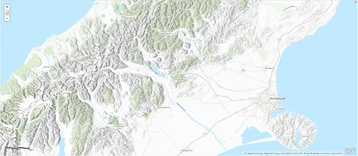
Waikato Open Data LAUNCH and Information Session
HawkEye 360 Introduces Strategic Partner Program and Announces Eagle Technology as the Strategic Partner for New Zealand
HawkEye 360 continues building a global presence, with Eagle Technology to bring radio frequency (RF) geoanalytics to New Zealand.
PRESS RELEASE UPDATED: AUG 21, 2018
HERNDON, Va., August 21, 2018 (Newswire.com) - HawkEye 360 Inc., the first commercial company to use formation flying small satellites to create a new class of radio frequency (RF) geoanalytics, is introducing a Strategic Partner Program to broaden access to its products and announces Eagle Technology as the Strategic Partner for New Zealand.
“HawkEye 360 is building an international network of partners that will help us commercialize and distribute our unique analytics,” said Beau Jarvis, Chief Revenue Officer, HawkEye 360. “We consider Eagle Technology a key ally, with expertise to apply our data to better serve the people of New Zealand. Not only are they a talented team of RF and geospatial professionals, but they are also a premier provider to their local and national governments.”
Eagle Technology will distribute and build upon HawkEye 360 analytics for a variety of applications, such as Maritime Domain Awareness (MDA) and spectral mapping. HawkEye 360 can identify and track ships based on radio signals, which will enable Eagle Technology to monitor the oceans around New Zealand and near Antarctica for environmental, economic and security concerns. HawkEye 360 can also precisely map active radio emissions, equipping Eagle Technology to locate interfering signals and advise on how to efficiently deploy spectrum.
“HawkEye 360 is building an international network of partners that will help us commercialize and distribute our unique analytics. We consider Eagle Technology a key ally, with expertise to apply our data to better serve the people of New Zealand.”
BEAU JARVIS
CHIEF REVENUE OFFICER
“Eagle Technology has a long history of bringing innovative solutions to the New Zealand market and HawkEye 360’s data products and solutions are complementary to many of the other geospatial solutions that we already represent. We are excited to be able to take this capability to our local customers to enable and support their critical decision making,” said Duane Eagle, Managing Director, Eagle Technology.
Based in Auckland, Eagle Technology is the leading provider of Geographic Information Systems (GIS) and geospatial services for New Zealand and the South Pacific Islands, supporting a variety of commercial and government clients. The company has helped solve a range of challenges, from search and rescue and emergency management to making smarter decisions about utilities and infrastructure.
More information about HawkEye 360 can be found at www.he360.com. For information on Eagle Technology, visit www.eagle.co.nz.
About HawkEye 360
HawkEye 360 is a Radio Frequency (RF) data analytics company. We operate the first of its kind commercial satellite constellation to identify, process, and geolocate a broad set of RF signals. With this unique dataset and our suite of proprietary processing and machine learning tools, we create powerful data analytic products that solve hard challenges for our global customers. Our products include maritime domain awareness and spectrum mapping and monitoring designed to serve a wide range of commercial, government and international customers.
About Eagle Technology Group
Eagle Technology Group Ltd is a privately held New Zealand-owned information management company, formed in 1969. It has approximately 100 employees with offices in Auckland, Wellington and Christchurch. Eagle Technology has a long-established and successful geospatial technology practice in Geographic Information Systems (GIS) and related technologies, communications and Field Force Management as well as expertise and experience in on-premise ICT infrastructure, Cloud and managed services provision. Eagle Technology is the distributor for global software leader Esri’s ArcGIS platform in New Zealand and the South Pacific. Its traditional client base is in government, local government and enterprise-class commercial organisations.
Eagle Technology Group Ltd opens Christchurch office
AUCKLAND – 6th March 2018 –
Eagle Technology Group Ltd has opened an office in Christchurch to support its South Island client base. Located in the central city, the office makes real the ‘virtual’ office that has been run by Kenna Kelly, principal Account Manager for Eagle’s South Island customers, since the earthquake of February 2011. Joining Kenna is a full service team offering Professional Services and Technical Support.
Duane Eagle, Managing Director, Eagle Technology, says the office is the culmination of a plan that began more than seven years ago. “We first opened our Christchurch office in January 2011 in Victoria Street, an area that suffered extensive damage just one month later, and necessitated Kenna’s move to her home as a base, supported remotely by the wider team out of Wellington and Auckland. During this time our South Island customers have grown to include more than 150 organisations across sectors including Local Government, Infrastructure, Agriculture, Utilities, Education, Iwi, Consulting and Business.”
“We have a number of very long-standing customers, particularly in local and regional government , as well as a burgeoning number in other sectors, such as Forestry and Infrastructure. As a full-service IT infrastructure and GIS practice, we’ve provided GIS solutions to solve a number of problems relating to the Christchurch re-build, and have been active in assisting with Common Operating systems for Emergency Management teams in more recent events, such as the Port Hills fires and the Kaikoura earthquakes. So it’s very exciting after a seven year hiatus, to have a permanent, accessible local base for our team and our customers.”
Eagle Technology is the distributor for Esri’s ArcGIS platform, and will also now be offering instructor led training courses in Christchurch as part of the regular training schedule.
Christchurch Office Location:
Eagle Technology, Billens Building, Suite 7, Level 1, 177 High St, Christchurch, 8011
Postal:
Eagle Technology, PO Box 22656, CBD, Christchurch, 8140
29 November 2017
Duane Eagle steps into Leadership Role
The Board of Eagle Technology wishes to advise the resignation of Mark Allan, CEO, effective today. The Board acknowledges the considerable contribution Mark has given to Eagle Technology through the past eight months as Eagle has effected change and growth as a full-service Geospatial, Communications and Managed Services provider.
“Mark has been instrumental in identifying key markets and managing internal processes to meet demand as our business continues to grow. He leaves Eagle to pursue personal and other business interests,” says Duane Eagle, Executive Director, Eagle Technology.
The Board wishes to announce that Duane Eagle will assume Mark’s responsibilities, stepping into the leadership role for the family owned business that was established by his late father Trevor Eagle and his mother, Corallie Eagle, forty-eight years ago.
Duane Eagle has worked in the business for twenty-seven years, initially in Sales, as Business Development Manager and in his current role for the past five years.
Mapping tool to help wilding conifer control
NZ Esri Young Scholar
The Esri Young Scholar Award is about recognising the very best GIS students around the globe. Every year, Esri's global partners nominate 25 university students for excellence in relation to a GIS project. These projects include comprehensive research papers, software development, impactful maps, and apps that promote education, conservation, disaster response, and urban planning.
NZ Esri Young Scholar Award 2017 – Winner
Eagle Technology is pleased to announce Leigh McKenzie of the University of Otago as the Winner of the NZ Esri Young Scholar Award 2017.
To recognise this achievement, Leigh will be attending the Esri Education Conference and Esri User Conference in San Diego in July 2017.
Leigh’s project entitled Using a Geodatabase to Assess Vulnerability to Sea Level Rise in Greater South Dunedin focused on a subject that potentially has serious repercussions for many low lying areas of New Zealand. ArcGIS was utilised in her project to provide further understanding about what could go on in South Dunedin as sea levels rise.
For more details on Leigh’s project view her poster at:
Using a Geodatabase to Assess Vulnerability to Sea Level Rise in Greater South Dunedin
The entries this year were really exceptional and Eagle Technology commends the following outstanding projects for the NZ Esri Young Scholar Award 2017.
- Euan Forsyth for his Walking to scale: Utilising ArcGIS to implement a residential scale walkability index in Auckland project and
- Stephen Ford for his Lightning Strike Prediction – Protecting Critical Assets project.
His charity GIS in Conservation (GiC) was set up four years ago to help conservationists do their trapping, planting, and weeding work more easily (see the case studies below).
American-born Parker brought Geographic Information Systems (GIS) to New Zealand in the 1980s, when he was working as a salesman for New Zealand-owned IT company Eagle Technology. The powerful US mapping technology proved popular, and Parker sold it to lots of organisations, including the Department of Conservation, Ministry for the Environment, OSPRI, health authorities, and regional councils.
Fast forward 30 years, and conservation groups such as Forest & Bird anywhere in the world can now access GIS technology for just US$100 a year, thanks to the generosity of the American developer Esri. But using the complex computer-based technology was a barrier for many.
In 2012, Parker, decided he wanted to set up a charity to help conservation groups use the GIS technology. Parker explains: "I felt bad. I would throw this complex software at conservation groups and then leave them to it. So, I thought, why not use my experience and my love of New Zealand to give something back and make a difference?"
Parker’s idea was to establish a core group of geospatial expert volunteers who could help conservation groups harness the mapping tool for the benefit of their conservation work. The volunteers and GiC’s committee of experts support projects in different ways, depending on their complexity. "It has been easy to get volunteers. Many of them are very skilled and are keen to help New Zealand’s conservation the skills of our volunteers. It could be anything from an easy mapping project up to something very complex."
"I want New Zealand to be pest-free. That’s the big picture, that’s the vision we’re all after."
GiC has helped Forest & Bird projects in the past, and Parker would be pleased to hear from any members who would like to tap into GiC’s resources to help their conservation efforts. You can contact him by emailing gisconservationnz@gmail.com.
Full article including CASE STUDIES
To find out more about GiC, see www.gicnz.org.nz.
*A version of this story first appeared in Forest & Bird magazine http://bit.ly/2h3SBAu. You can find out more about Forest & Bird’s work at www.forestandbird.org.nz
New Zealand wins big at Asia Pacific Spatial Excellence Awards
Eagle Technology congratulates the winners of the Asia Pacific Spatial Excellence Awards, announced at the Locate Conference in Sydney on April 5. In particular we congratulate all NZ winners and customers.
- Wellington City Council wins Supreme Award for Living Lab
- NZTA wins Spatial Enablement Award
- LINZ highly commended for improving geodetic datum
- Wendy Lawson (Canterbury Uni) Professional of the year
- Mike McConachie (Otago Uni) Postgraduate of the year
- Wellington City Council wins People & Community award
Imagery Basemap
Over the last 4 years, Eagle Technology has worked with Land Information New Zealand (LINZ) and other NZ Government agencies to take New Zealand’s most current publicly-owned aerial imagery, covering over 95 percent of the country, and make this available as an open, freely available high performance Imagery Basemap. Last month this Basemap was updated with the latest imagery data captured by NZ Transport Agency (NZTA) and numerous Local and Regional Government agencies and was also enhanced to support more detailed, higher resolution views. This Basemap complements the other Eagle basemaps created from publicly-owned vector data – the NZ Topographic, NZ Community, NZ Dark Grey and NZ Light Grey basemaps. These basemaps are extremely popular, receiving millions of views each year, and now will have even more uses having also been updated with the latest data including roads, parcels and addresses.
Details of the imagery updates can be seen in this interactive Storymap.
Below are the current updates with more due over the next 6 months. In areas where this imagery supports higher resolutions the Basemap has been cached down to the 1:564 and 1:282 scale levels (*) allowing users to zoom in to street-level detail.
Northland 0.1m Urban Aerial Photos (2014-15) *
Auckland 0.075 Urban 2015 *
Waikato District 0.1m Urban_2014 *
Hamilton 0.1m Urban_2015 *
Hawkes Bay 0.3m Rural Aerial Photos (2014-15)
Wairoa 0.1m Urban Aerial Photos (2014-15) *
Hastings 0.1m urban aerial photos (2014-15) *
Whanganui 0.1m Urban Aerial Photos (2015-16) *
Palmerston North City 0.125m Urban Aerial Photos (2014-15) *
Marlborough 0.2m Rural Aerial Photos (2015-2016)
Tasman 0.3m Rural Aerial Photos (2015-16)
West Coast 0.3m Rural Aerial Photos (2015-16)
Canterbury 0.3m Rural Aerial Photos (2014-2015)
Waimakariri 0.075m Urban Aerial Photos (2015-16) *
Christchurch City 0.075m Urban Aerial Photos (2015-16) *
Canterbury 0.3m Rural Aerial Photos (2015-16)
Southland & Central Otago 0.4m Rural (2014)
Southland & Central Otago 0.4m Rural 2015
Invercargill 0.1m Urban Aerial Photos (2015-16) *
Invercargill 0.05m Urban Aerial Photos (2015-16) *
West Coast Sh6 0.15m (2016) *

Eagle Technology is a stakeholder and supporter of Predator Free NZ (PFNZ) a charitable trust formed to connect, inform and inspire others to get involved in the cause to protect New Zealand’s endangered native species by eliminating the threat of introduced predators such as possums, stoats and rats.
Eagle brings its strong expertise with geospatial data and technology to map and analyse the predator management work being done across the country. To do this Eagle has been collaborating with organisations such as OSPRI, Department of Conservation, Nga Whenua Rahui, and regional councils to create a ‘Big Picture’ map of New Zealand showing where the gaps and opportunities lie, thus allowing the many organisations across NZ to focus their resources where and how they can be most effective.
An example of this mapping can be seen on the PFNZ website (http://predatorfreenz.org/the-big-picture/) as well as in a dedicated map viewer (http://pfnz.maps.arcgis.com/apps/Viewer/index.html?appid=00e67ff4ce7347b5976d7142b3dcc227).
As a key part of this support, Eagle’s Chief Executive Gary Langford is also a Trustee and member of the PFNZ Board helping to steer the organisation. Below is the press release from Predatro Free New Zealand.
Bold Plan to make New Zealand predator free
A group of New Zealanders and independent businesses are joining forces with government agencies to create a predator free New Zealand – eradicating all rats, possums and stoats and other predators to native bird life and conservation.
The group formed the Predator Free New Zealand Trust, which will receive $575,000 over the next two years from the Community Conservation Partnerships Fund.
The Trust unveiled the first stage of its vision at the ‘A Place to Live’ conference in Whanganui today. It revealed a map displaying predator control areas already undertaken by public and government agencies including OSPRI, DOC and regional councils.
Stage two of the Trust’s work focuses on community and private efforts, which are underway or planned.
Chairman of Predator Free New Zealand Devon McLean said the secret weapon in this battle was the countless number of New Zealanders, mainly volunteers, already dedicating millions of hours controlling the predators.
However, he said, becoming predator free would not be an easy task and would require new innovation and real commitment from all New Zealanders.
“We believe the only way that New Zealand can be predator free is if all Kiwis, in every community, in every region, accept some of the responsibility and join in the fight.”
Gareth Morgan was one of the business leaders supporting the Trust. Eliminating predators was important to secure a future for our threatened native species, including our national emblem the kiwi, Dr Morgan said.
It was also a boost to our vital tourism industry, reduced diseases and increased farm output resulting in gains for our food exports and an enhanced international reputation.
The vision of a predator-free New Zealand is the brainchild of eminent physician Sir Paul Callaghan, a native of Whanganui. At his last public lecture in 2011, Sir Paul likened the vision to the first Apollo mission, saying “It’s crazy, it’s ambitious but I think it might be worth a shot”.
Trustee Professor Charles Daugherty, of Victoria University, said the Trust was a necessary investment to protect our biodiversity for future generations and secure what we most treasure about being New Zealanders.
Contact Nicky Barton 0273060603 or 04 499 6940