Behind the Scenes of Election17
Behind the Scenes of Election17
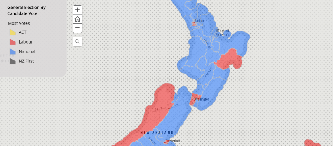
This year Eagle Technology partnered with Radio New Zealand for the Election17 coverage, producing their live-updating election maps on the night. This blog post will reveal the technical tips and tricks behind how these maps were made.
What we had to work with? The Electoral Commission released their results for the 2017 Election publicly in xml format.
So how do we take this data and transform it into colour changing and winner naming maps?
To do this we used a combination of FME, ArcGIS online and arcade expressions. These were used for the following workflow;
XML to ArcGIS Online hosted feature layer
The election results were available to us in xml. FME was used to convert this xml feed into two ArcGIS Online Hosted Feature Layers (Polygons of the General Electorates, and Māori Electorates) and an ArcGIS Online table.
From these Feature Layers we could create various Web Maps and Web Apps on ArcGIS Online. The main product on the night was a Storymap which included a graph of the live party votes for all electorates and main centres.
Arcade Expressions
Arcade is the secret behind what made our maps perform and appear well on the night. This language was used throughout for the customization of the popups and symbology of the electorates. Examples of some tasks arcade allowed us to do were;
- Calculate which party or candidate was currently in the lead
- Make the popup show the name of the winning party in their party colour
- Control what candidates show up for an electorate in the popup
- Show the winning margin between candidates
- Show the 2nd Place Candidate
Learnings from this experience
- When editing symbology on a hosted feature layer which has multiple feature layer views originating from it. try to get the symbology, popups and arcade done on the original feature layer prior to making the views (this will reduce a lot of repetitive tweaking on layers).
- Having important details like colour hexcodes on standby is really useful for the amount of times you have to copy and paste!
- Take care while creating maps with feature views . Do not “Save Layer” and over write the layer settings (i.e.symbology and for a brief monent make the whole map purple. Creating a new view for this sort of testing is advised as best practice.
Overall this was an incredible opportunity for the Interns to use our knowledge gained over the last few months, and work on a high-profile project alongside other members of the Eagle Technology Technical Team.
Our storymaps from the night are still live (with special votes), and can be viewed here: http://eaglegis.maps.arcgis.com/apps/MapSeries/index.html?appid=bfe1903e...
View all blog posts