NZ Basemaps Update Information
NZ Basemaps Update Information
It's that time of year when everyone's minds turn to...GIS Basemaps! So, to round out the year we thought we’d give you a quick update on where we are with the super popular Eagle Basemaps.
Imagery Basemap Improvements
Firstly, a bit of an update on the latest changes to the awesome NZ Imagery Basemap where we’ve tweaked the settings and imagery to make it even more useful...
No Image...No More
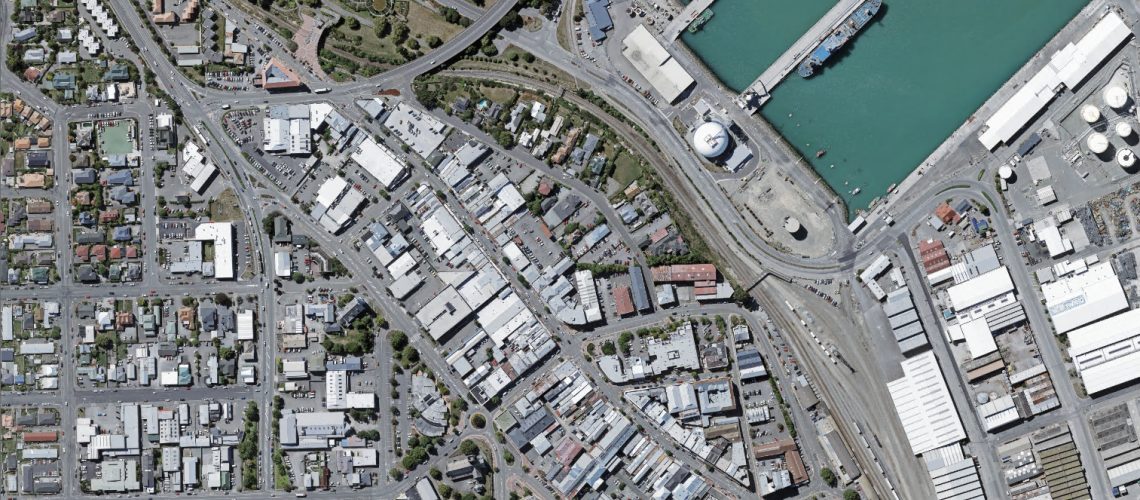
Have you ever experienced the dreaded grey tile telling you “No image is available”, when zooming into an Imagery Basemap? Well, with our latest update this issue is no more! We have used a technique called ‘resampling’ which replaces this message with the highest-resolution imagery available for that area. The imagery may not be as crisp in rural areas as it is in urban areas, where higher-resolution imagery is available, but it sure gives better reference than a grey tile!
Imagery Basemap Before...

Imagery Basemap now!

Updated and Improved Imagery
The Imagery within this Basemap has also had over 20 updates this year including both urban and rural areas with more to come in the first part of next year. These 2019 updates include the following:
-
Mid & South Canterbury Urban/Rural
-
North Canterbury Urban
-
Northland Urban 2015 Imagery (extended content)
Incoming Mid/South Canterbury Updates:
Ashburton Domain Old

Ashburton Domain New

Stafford Street Timaru (Before)

Stafford Street Timaru (Now)

Metadata Rocks!
Finally, on the Imagery Basemap – we wanted to make sure that you all know about a great way to see e.g. how old the imagery that you are looking at is. We maintain a layer of all of the imagery footprints along with metadata showing the “who, when and how” of the captured imagery. This can be access from the REST service here and easily added to any of your webmaps.
Other NZ Basemaps
Outside of the Imagery Basemap we of course keep the other Basemaps up to date including the Canvas & Community ones. These will have a data refresh over the Christmas New year period (no holidays for the servers).
Vector is the future: Faster, Smaller, Cooler!
Finally, a bit of an exciting sneak peak at what's to come in 2019….
In 2019, coming soon to a map near you are new Eagle Vector Basemaps. Vector Basemaps are lightweight in comparison to their traditional cached counterparts – 10’s of GB compared to 100’s – making them ideal for downloading for offline use, and, require far less time to process, meaning we can provide you with weekly data updates straight from the LINZ Data Service.
We plan on first rolling out Esri-styled vector Basemaps, however, with tools like the ArcGIS Vector Tile Styler Editor, you can customise their symbology to truly make them your own.
And, if you’re worried about the support of our current cached Basemaps, don’t be! Our vector Basemaps will be offered as a new alternative, ready to be taken advantage of in ArcGIS Pro and ArcGIS Online. They can even be published as Vector PDFs!
Below is a quick sneak peek of a new and updated Community vector Basemap!


Have a great Christmas and New Year and while you’re relaxing on the beach just spare a thought for the poor servers…
The Eagle Basemap Team
View all blog posts