NZ LiDAR Competition
NZ LiDAR Competition
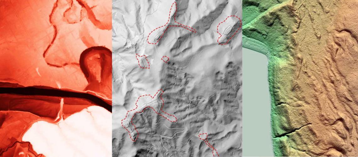
With the NZ National Elevation Programme providing more and more freely available LiDAR data for NZ, we wanted to hear about some of the great ways in which you are using this treasure trove of data along with ArcGIS to solve issues of all kinds, all scales and all across New Zealand.
So, to help gather these stories, we are asking you to tell us about your work based upon the newly available LiDAR data as well as derived data sources such as Eagle Technology's Elevation WebService which incorporates this data.
We believe that this data, when combined with tools such as ArcGIS Pro, 3D scenes and Deep learning workflows, will open up opportunities for almost every sector in the country and with your permission, we will share your stories with LINZ, helping to show others what’s possible as well as helping reinforce the business case for future investments of this kind.
On top of this though, we will also be choosing one story which shows innovation in addressing a real-world issue for NZ for a little bit more celebration...
This one submission which we feel really stands out, will be showcased on our website as an example to others and in recognition of your work, we'd like to take the opportunity to host you and your team on the Eagle Magic for a day's private charter!
So, how do I submit my story?
Create a StoryMap to tell us:
- How you are using ArcGIS + NZ LiDAR together (LiDAR from the NZ Elevation Programme or derived products)
- What problems are you solving? How are you making a difference for those outside of the GIS industry? How are you doing things more efficiently or effectively?
- What kinds of innovations are you making (big and small)?
Then simply send us a link to your StoryMap before the 28th February 2022 closing date: nzeuc@eagle.co.nz
Good luck and we can’t wait to hear about all of your cool projects.
View all blog posts