![]()
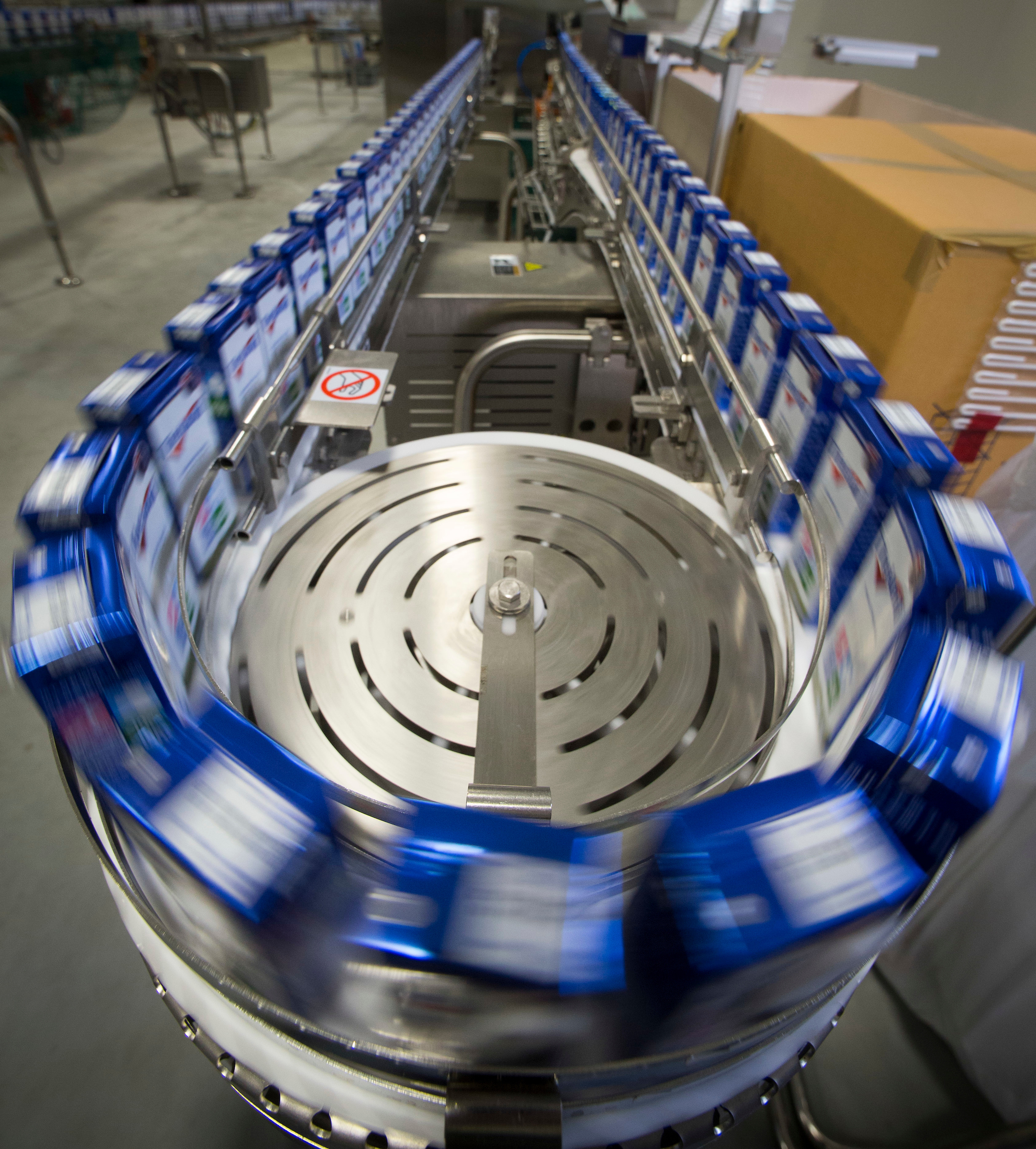
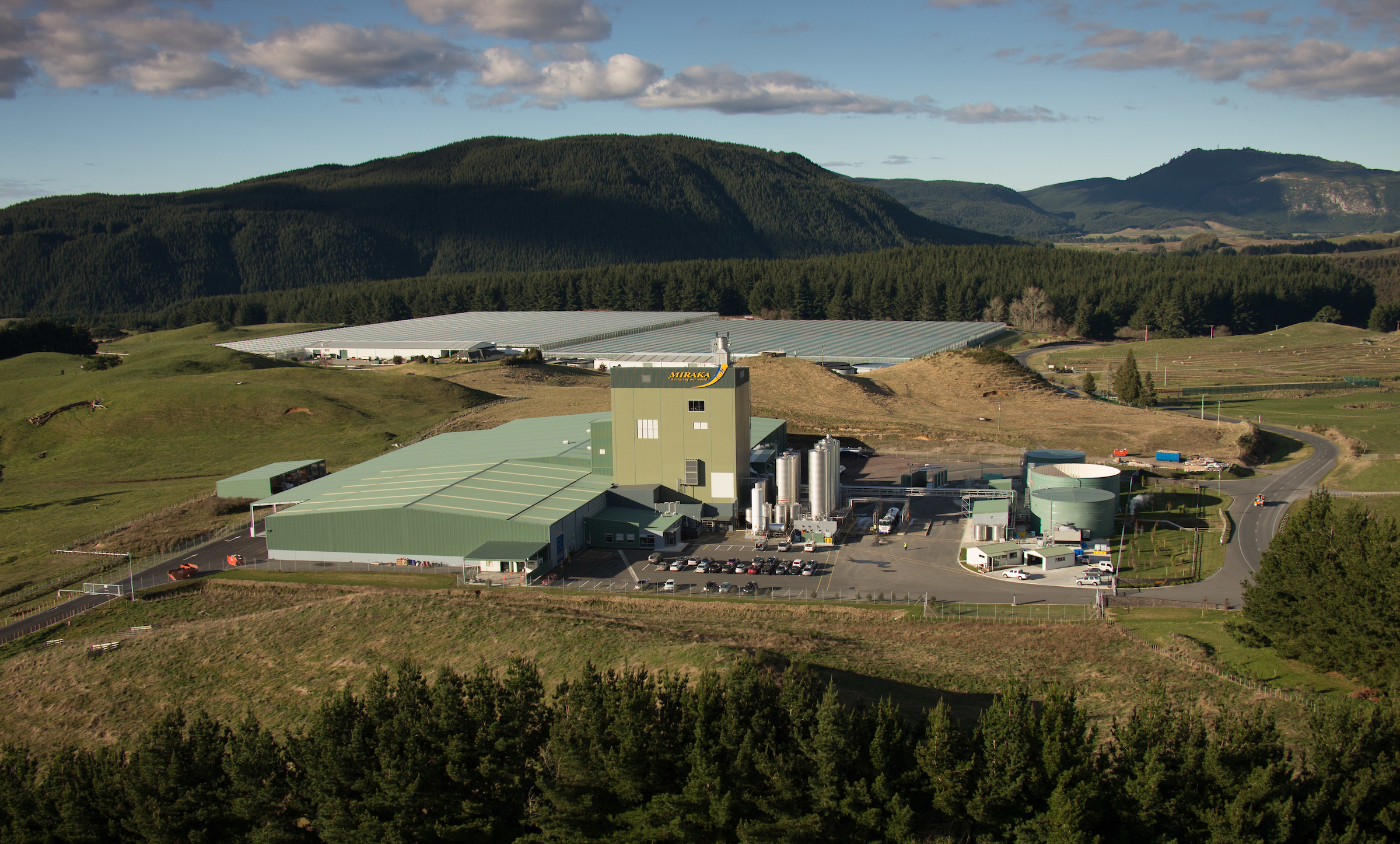
Located 30 kilometres north-west of Taupo in New Zealand’s Central North Island, Miraka is a Māori-owned organisation with a history of innovation and a focus on making decisions that reflect a long-term view. Miraka exports its premium milk products globally and its goal is to become the world’s most sustainable dairy company. This is being achieved by sustainably managing their 104 supplier farms applying Esri’s ArcGIS technology. Another key aspect of Miraka’s sustainable approach includes using renewable geothermal energy to generate quality milk products from over 300 million litres of milk annually.

Protecting the environment in which it operates is extremely important to Miraka and its shareholders, reflecting the principles of kaitiakitanga (guardianship) of the land, for current and future generations.
Using Esri’s ArcGIS technology tools supplied by Eagle Technology has enabled Miraka to identify critical risk features on each farm that could contribute to potential environmental degradation. Miraka chose ArcGIS as it provides a big-picture view as well as very detailed information for its farmers. Using ArcGIS also enables the company to add on extra modules to comply with new environmental regulations as they came into effect. In addition, ArcGIS is used by the local body that will be monitoring farm compliance with these new regulations.
Miraka invested in implementing a full ArcGIS system supplied and supported by Eagle Technology to develop sustainable milk plans for its supplier farms. This followed a sector-wide initiative to review each farm property, identifying waterways and fencing off waterways, wetlands and dams. Previously this information had been captured and documented in paper format.
“For us, it’s always been about valuing kaitiakitanga and making decisions with the long-term view,” says Murray Hemi, Miraka’s Kaitiaki and Environmental Leadership General Manager. “By supporting our farmers to apply environmentally sound practices we are helping to create climate-resilient farms and world-class milk products.”
From 2019, with Eagle Technology’s assistance, Miraka has used ArcGIS tools to proactively begin a comprehensive data capture of potential environmental risks on each of its supplier farms. Miraka’s initial focus was on ensuring its farms were complying with the Government’s National Policy Statement for Freshwater Management which came into effect in September 2020 under the Resource Management Act 1991.
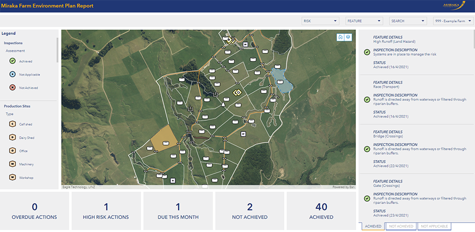
The environmental risks on each farm are being progressively identified and captured within Miraka’s ArcGIS system by the company’s certified farm environmental planner Warren Landles.
The company’s goal is to develop customised environmental plans for each of its farms once all the data has been captured. These plans will assist Miraka’s dairy farmers to comply with anticipated new environmental regulations and facilitate gaining council permits for land use. Farmers have until 2025 to ensure they have completed an environmental plan.
“Each farm environmental plan will become a living document that can be updated as required,” says Warren. “ArcGIS enables us to identify critical risk features on each farm that could contribute to potential environmental degradation. This will show us where farmers need to focus their efforts to mitigate these risks. The areas requiring action will be shown on live geospatial maps and dashboards bringing data to life. This information will be accessible to farmers at any time.”
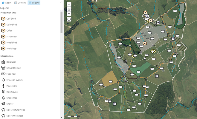
“We have created 14 different layers for Miraka on ArcGIS, representing various typical categories relating to a farm,” says Eagle Technology Adviser Ryan Cooper.
These layers can include anything from infrastructure (wells, troughs and feeding pads), to crossings (bridges, culverts, gates). Using the ArcGIS Field Maps app Warren locates any bridges on a farm at the point of capturing data and identifies their attributes. Warren can then physically inspect these bridges on site and check that regulatory standards are being met.
Using ArcGIS Warren is also capturing data on each farm regarding any potential hazards such as offal holes, emergency pits, slips, and locations where chemicals are stored.
Another aspect of his data capture on a farm is the identification of the percentage of effluent cover in a farm’s paddocks. Warren will then run ArcGIS API for Python script to monitor if the farm’s percentage of effluent coverage meets regulatory standards. Python will bring up the relevant regulation and relate it to the effluent percentage coverage that’s been captured. If the percentage exceeds the regulatory levels, Python will raise a red flag and drop a point on a farm’s map. Warren can then identify what the farmer needs to do to correct the percentage and set a recommended time frame in which to carry out this work. Python’s checklist of regulations can be applied over a range of different standards on every farm.
“This is a great time saving and a way of future-proofing a farm,” says Eagle’s Ryan Cooper. “It identifies what to do, when and how. It highlights the areas in which a farmer is not compliant.”
When all the data has been captured and the environmental plans have been completed each farmer will gain viewing-only access to their plan and geospatial map data on the ArcGIS dashboard through Miraka’s website portal. The farmer will then be able to see clearly what type of actions they need to take to mitigate environment risks and to comply with any future regulations related to reducing gashouse emissions and protecting and enhancing biodiversity on their farms.
Each farm will be audited on an annual basis by their local council to measure their progress with implementation of their plan. Data can be shared with the council via ArcGIS in a restricted view that protects a farmer’s confidential information.
“With the help of Eagle Technology, we are creating an environmental farm management template that we believe will be world-leading,” says Grant Jackson, Miraka’s General Manager of Milk Supply. “It will enable our farmers to better understand what their environmental risks are. To most of our supplier farmers geospatial technology is totally new. We needed technology that was intuitive so that farmers could look at it and be able to relate to it and understand it straightaway. We selected the ArcGIS platform as it was also being used by our regulators, such as local bodies, enabling a transparency in the flow of information.”
Once they have accessed their environmental plan, farmers can decide how they will adopt more sustainable farming practices on their farm. This might involve determining that a particular section of their farm will not be cultivated, or that an area is fenced off and planted with trees.
“We are not dictatorial about what farmers must do, it’s very much a partnership,” says Grant Jackson. “We encourage our farmers to come up with their own solutions and we help them to become better informed so that their relationships with the regulatory authorities are positive.”