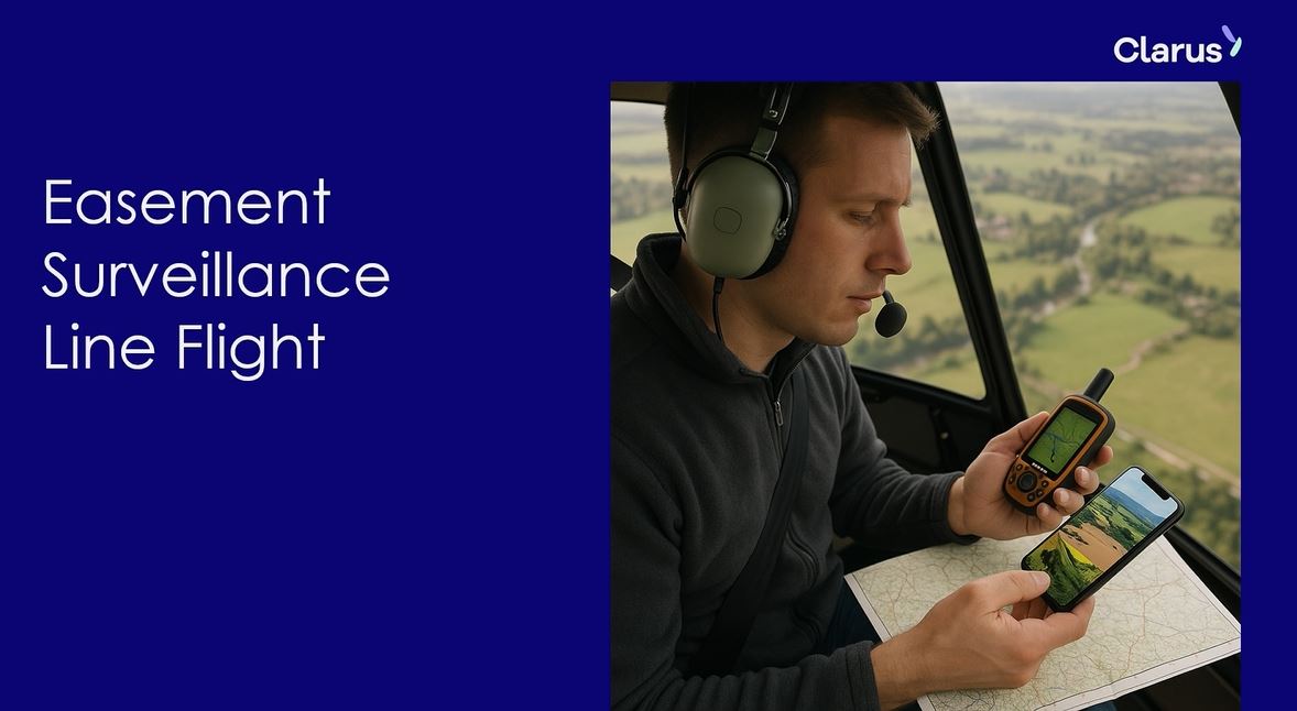
When Clarus needed an innovative way to survey Firstlight Network’s electricity corridor, the energy group turned to Esri software.
Clarus group is one of New Zealand’s largest energy providers, serving more than half a million homes and businesses. It already had experience using Esri software with its business Firstgas, which operates an extensive underground gas pipeline network that requires regular aerial surveillance to ensure safety.
After Clarus acquired Eastland Network (now Firstlight Network) two-and-a-half years ago, the team discovered that line inspections for the electricity network were still carried out with pen, paper, and a helicopter ride.
“When I visited the Gisborne office, the inspector was flying with a giant spreadsheet, scribbling notes, then trying to match photos on his laptop afterwards,” recalls Tony Standen, GIS Manager at Firstgas. “It was clever, but far from efficient.”
Turning paper into digital insight
Standen and GIS analyst Todd Williams saw an opportunity to bring the same digital innovation used at Firstgas to Firstlight Network. Williams had already developed the Pipeline Easement Surveillance App using Esri’s ArcGIS platform, distributed in New Zealand by Eagle Technology.
|
|
|
The GIS Mobile app developed by Clarus for easement surveillance to collect hazard observations around the Firstlight network. |
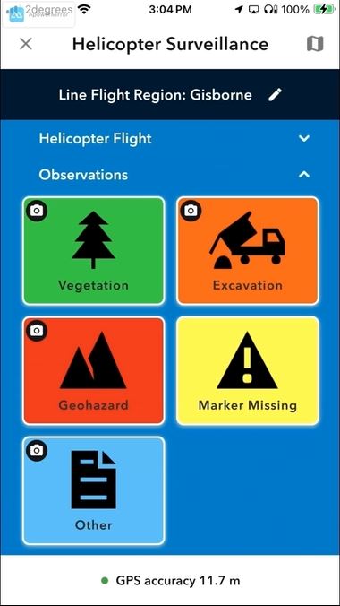
They adapted this into a new ArcGIS Experience Builder application paired with the ArcGIS QuickCapture mobile app. Instead of juggling paper in a helicopter, inspectors now use their phones to capture geotagged photos, record hazards, and tag assets in real time.
The data is sorted into categories such as vegetation, excavation, geohazard, or missing markers. It’s then visualised through a custom 2D/3D GIS Viewer, enabling instant review and analysis back in the office.
Faster, Smarter, Safer
The impact has been immediate.
- Speed: Inspectors can now cover 350 km of lines in under four hours — a task that once took a full day.
- Accuracy: GPS-linked photos provide precise, auditable records of what was seen and when.
- Resilience: With Gisborne’s exposed terrain and recent severe weather events, timely inspections are critical.
“The new app is great,” says Firstlight Network’s electrical transmission asset specialist, Richard Leckie.
“We flew all the lines in under four hours, picked up nearly 400 photos, and even captured tricky sites like a pole in the middle of a river.”
The solution has already saved an estimated $10,000 in helicopter time, while also improving fault responsiveness and minimising downtime.
A Game-Changer for Utilities
Standen calls the technology “a complete game changer” for Firstlight Network, while Williams sums it up as “a huge time-saver.”
Eagle Technology account manager Dan Clark says the solution is a powerful example of how ArcGIS can transform utility operations.
"By combining ArcGIS QuickCapture with aerial patrol workflows, Firstlight has significantly accelerated their inspection process while improving the accuracy and timeliness of critical data.
"These kinds of innovations don’t just boost internal efficiency, they also enhance the resilience and reliability of the network, delivering real, measurable benefits to the communities they serve."
The project has since been showcased at the Esri User Conference in San Diego and featured at the New Zealand Esri User Conference in Christchurch in September.
 |
|
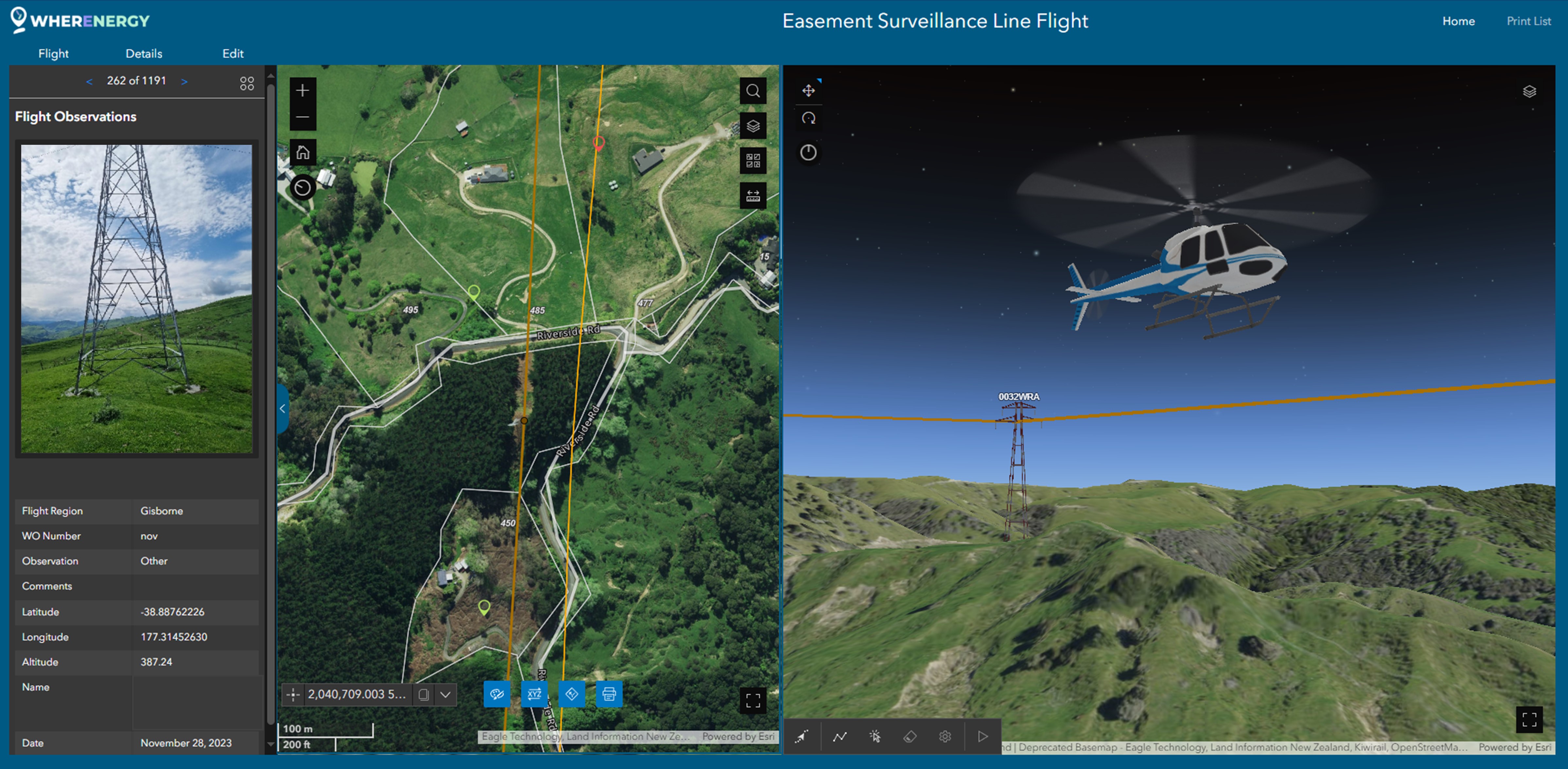
Back in the office the GIS Map Viewer app developed by Claus can review and analyse the hazard observations collected in the field. |